非常抱歉,
你要访问的页面不存在,
非常抱歉,
你要访问的页面不存在,
非常抱歉,
你要访问的页面不存在,
验证码:

职称:Professor
所属学校:University of Maryland-College Park
所属院系:College of Behavioral and Social Sciences
所属专业:Geography
联系方式:(301) 405-2284
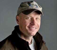
Prof. Matthew Hansen is a remote sensing scientist with a research specialization in large area land cover and land use change mapping. His research is focused on developing improved algorithms, data inputs and thematic outputs which enable the mapping of land cover change at regional, continental and global scales. Such maps enable better informed approaches to natural resource management, including deforestation and biodiversity monitoring and can also be used by other scientists as inputs to carbon, climate and hydrological modeling studies. Prof. Hansen's work as an Associate Team Member of NASA's MODIS Land Science Team included the algorithmic development and product delivery of the MODIS Vegetation Continuous Field land cover layers. His current research includes taking the global processing model for MODIS and applying it to the Landsat archive. Exhausting mining of the Landsat archive has been used to map forest disturbance in the Congo Basin, Indonesia, European Russia, Mexico, Quebec and the United States. The methods developed in these efforts will be used to test global-scale disturbance mapping with Landsat data. Other current research efforts focus on improving global cropland monitoring capabilities, for example global soybean cultivated area estimation using MODIS, Landsat and RapidEye data sets. For a more in depth look at his reserach lab's projects, reserach focus and publications, visit the Global Land Analysis and Discovery lab here.
2011- Professor, Department of Geography, University of Maryland, College Park, MD Perform research on land cover extent and change at national, continental and global scales, advancing research methods to operational implementations in collaboration with government and non-government partners. Teach classes on land cover characterization using remotely sensed data sets and regional geographies. Provide service in support of department and campus as well as professional organizations. 2004-2011Co-Director and Professor, Geographic Information Science Center of Excellence, South Dakota State University, Brookings, SD Led new research center on the science of large area earth observation and monitoring. Initial tasks included the hiring of 5 faculty and administration of new doctoral program in Geospatial Science and Engineering. Developed interdisciplinary research agenda to utilize engineering to efficiently and accurately process data, geography to create meaningful thematic depictions of land cover and land use change, and science applications to focus on the resultant effects of change on the geosphere, biosphere and hydrosphere. 2002-04 Assistant Research Scientist, University of Maryland, College Park, MD Managed and performed analytical tasks as investigator on multiple land cover mapping projects. Developed and implemented procedures for classifying land cover and detecting land cover change, including non-traditional approaches for describing land cover transition zones and mosaics. Produced first global forest change estimates from satellite data for the years 1982-1999. Led field validation activities for continuous field tree cover mapping project of the lower 48 United States and for selected sites in central Africa and the Amazon. 1994-02 Faculty Research Assistant, University of Maryland, College Park, MD Developed and implemented methodologies for mapping land cover at the global scale using remotely sensed data sets. Work included the first supervised classification of the earth surface at a 1km spatial resolution. Created a multi-resolution approach to mapping percent cover. This work led to an operational algorithm used with the MODIS sensor to produce global continuous fields of vegetation characteristics at a spatial resolution of 500 meters. 1996/2003 Class Instructor, University of Maryland, College Park, MD Taught senior/graduate level digital image processing class. Developed syllabus, lectures, exams and wrote exercises for laboratory section of class. Also taught junior-level Geography of Africa class, including physical, social, political, economic and historical aspects of Sub-Saharan African geography. Duties included writing syllabus, lecturing and developing writing-intensive examinations and exercises. 1991-94 Graduate Teaching/Research Assistant, University of North Carolina at Charlotte Instructed analytical laboratory procedures for an introductory Earth Sciences class. Taught digital image processing techniques of remotely sensed data sets for the laboratory section of a lecture class. Also, led field research responsible for data acquisition and analysis for water resources project. Duties included digital image processing, depth profiling, radar scanning and sediment sampling of retention basins in metropolitan Charlotte. 1988-91 Aquaculture Extension Agent, United States Peace Corps, Bandudu, Zaire (DRC). Initiated aquaculture practices in 25 rural villages. Taught individual farmers comprehensive fish farming techniques including site selection, construction, stocking, raising, harvesting and marketing. Engineered twenty-five gravity flow multi-pond systems and oversaw the construction of 43 ponds.